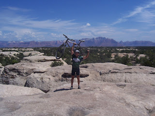
Here's Ho on top of some of the slickrock formation with the Zion in the background. We continued like this for a few miles, not gaining anything in overall altitude but all the short ups really start to add up. There is also almost no shade and the sun beat on us pretty much all day. It wasn't too hot by Gooseberry standards, high 80's to low 90's but still hot.

We ran into a couple cuties, locals from down in St George, so we stopped to chat with them for a bit.
After about 4 miles you hit the first of the rim view points, a southern view that includes highway 59 and the town of Huricane down in the distance.
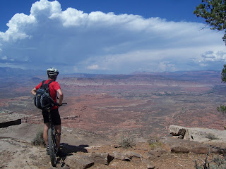
After another mile or so you make it out to the point with at least a 270 degree view including the one below

The ride out to the point was an out and back then after a bit of memory searching howie and I remembered that we took a degraded gravel road for a little bit then picked up the Yellow trail, a bit more technical than the first section, but similar slickrock. We crossed back over the road and caught the northrim trail

We could see the storm clouds starting to form in the mountains and began to get a little worried as the access roads turns to muddy impassible soup when they get much rain. We cut the ride a little short taking the most direct route back to the vehicles, but still a great ride. We were hustling to get things packed up and on the road when up drove two pretty clueless chicks drive up in a sporty little car, not sure how they made it back that far, but Craig had to go over and start chatting them up and then was a little upset when we were all ready to go, yelling at him to get a move on, and nobody had put his bike in the van. They took our suggestion and headed out too. We took the shorter, easier route back to pavement crossing our fingers the light rain didnt get any harder before we reached pavement. All went well and the route out left us with a longer mileage distance and no views of Zion, but it was the safest choice.
1 comment:
Gooseberry Mesa know that it is a destination for mountain biking.
Gooseberry Mesa
Post a Comment